Snow and ice warnings issued across the UK - here's the Met Office outlook for Shropshire
The Met Office has issued snow and ice warnings across the UK - here's the latest update on whether snow will come to Shropshire.
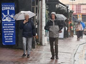
While parts of the country prepare for snow, it's looking like a particularly dull and damp few days for Shropshire.
A yellow weather warning for snow and ice will come into force over the border in Wales at 6pm today (Tuesday, January 3). The warning, which kicks in just west of Welshpool and Oswestry, will be in place until 9am on Wednesday.
It's one of four snow warnings issued by the Met Office across the UK - with disruption also expected in the Peak District.
But here in Shropshire, it looks like sleet is as snowy as it will get, with Met Office experts predicting a "dull and damp" few days for the region.

Tuesday will see a band of "persistent and heavy" rain and sleet spread across the county, with a chance of snow developing on hills. Daytime temperatures between 2C and 6C, but a brisk breeze will make it feel more like -2C at times.
There is a risk of mist and fog overnight and into Wednesday morning as the winds lighten, with the rest of the day expected to be a little drier and milder than Tuesday. Daytime temperatures will be between 3C and 8C.
A spokesperson for the Met Office said it's likely to remain "rather dull throughout the week" with limited brighter spells and an ongoing chance for outbreaks of rain.
West Midlands Met Office weather forecast
Today:
Widely cloudy and increasingly wet as rain spreads across the region, locally persistent and heavy, and falling as snow over the Peak District later. Feeling cold in the brisk breeze. Maximum temperature 6 °C.
Tonight:
A damp end to Tuesday with rain and hill snow only gradually clearing northwards overnight. Remaining cloudy after this with the potential for fog patches forming as winds fall light. Minimum temperature 2 °C.
Wednesday:
Murky in places to begin as low cloud lifts and lingering spots of rain ease. Drier from then on, perhaps with some brighter spells as well. Slightly milder than Tuesday. Maximum temperature 8 °C.
Outlook for Thursday to Saturday:
Remaining rather dull throughout the week with limited brighter spells, giving a cool feel. Some drier moments but with the ongoing chance for outbreaks of rain. Breezy at times.