Three flood alerts issued for Shropshire as further rain and strong winds forecast
Watch the Met Office forecast, as flood alerts are issued for Shropshire.
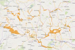
The Environment Agency has issued three flood alerts for Shropshire, with further rain forecast after a sunny Sunday morning.
The flood alerts - which mean ‘flooding is possible’ - are in place for the River Severn in Shropshire, the Severn Vyrnwy confluence and the Tern and Perry catchments.
River Severn in Shropshire
The flood alert for the River Severn in Shropshire reads: “Forecast high river levels today may lead to flooding. Flooding is possible on 22 February 2026.
“Flooding may affect low lying land and roads adjacent the river from Shrewsbury to Upper Arley. Locations that may be affected are White Abbey, Coalbrookdale, Ironbridge and Bridgnorth. River Severn bankfull at White Abbey, floodplain may be filling at Hayes Basin.
“Predicted peaks: Crew Green 5.2 to 5.6m on 22/02/26 PM, Montford 4.7 to 5m on 22/02/26 overnight, Welshbridge 2.5 to 2.8m on 23/02/26 AM, Buildwas 3.8 to 4.2m on 23/02/26 evening, Bridgnorth 3.1 to 3.4m on 23/02/26 overnight.”
Severn Vyrnwy confluence
The flood alert for the Severn Vyrnwy confluence reads: “Rising river levels may lead to further flooding today, 22 February 2026.
“Flooding may affect low lying land and roads adjacent to the river from the Welsh border at Llawnt to Shrawardine near Shrewsbury. Other locations that may be affected include Llanymynech, Maesbrook and Melverley. Roads between Maesbrook, Melverley and Pentre start to flood.
“Predicted peaks: Llanymynech 3.7m to 4.0m this afternoon and Cae Howel 4.0m to 4.5m this evening; Sunday 22 February 2026.”
Tern and Perry catchments
The flood alert for the Tern and Perry catchments reads: “River levels remain high in response to recent rainfall. Flooding is possible on 22nd February 2026.
“Flooding may affect low lying land and roads adjacent to the river from Wolverley to Newport. Other locations that may be affected include Market Drayton, Wem, and Rodington.”
When is rain next forecast for Shropshire?
Shrewsbury is forecast to have a sunny, spring-like morning on Sunday February 22, however strong winds are expected throughout the day, with a 50% and over chance of precipitation from 19:00. Top temperature of 12°C, low temperature of 8°C.
Telford is also forecast to have a sunny morning on Sunday February 22, but there is a 60% and over chance of precipitation from 21:00. Top temperature of 12°C, low temperature of 8°C.
Sunny intervals and strong winds are also forecast for Ludlow on Sunday February 22, but with a slightly lower chance of precipitation - 40% chance at 20:00, 21:00 and 23:00 and 50% chance of 22:00. Top temperature of 13°C, low temperature of 8°C.
Bridgnorth is also forecast to have a sunny morning on Sunday February 22, with a 40% chance of precipitation at 20:00 and 21:00 and a 50% chance at 22:00 and 23:00. Top temperature of 12°C, low temperature of 8°C.
Sunny intervals and strong winds (gusts of up to 35mph) are also forecast for Oswestry on Sunday February 22, with a 60% and over chance of precipitation from 18:00. Top temperature of 12°C, low temperature of 8°C.
Market Drayton is also forecast to have a sunny morning on Sunday February 22, but there is a 50% and over chance of precipitation from 19:00. Top temperature of 12°C, low temperature of 7°C.
Ironbridge is also forecast to have a sunny morning on Sunday February 22, but there is a 50% and over chance of precipitation from 20:00. Top temperature of 12°C, low temperature of 7°C.
Met Office West Midlands weather forecast
Sunday February 22 day
Cloud and rain clearing away southwards this morning to leave an increasingly bright day with lengthy sunny periods, albeit hazy at times. Breezy but very mild and feeling spring-like in the sunshine. Maximum temperature 13 °C.
Sunday February 22 night
A mix of clear spells and a scattering of showers overnight. The showers most frequent in the northwest, with one or two heavier showers possible. Mild but remaining breezy. Minimum temperature 7 °C.
Monday February 23
Some early brightness on Monday, but cloud will tend to increase towards lunchtime. Rain likely to move in throughout the afternoon, especially in the west. Staying mild. Maximum temperature 13 °C.
Outlook for Tuesday February 24 to Thursday February 26
Mostly dry but cloudy on Tuesday. Brighter with spells of sunshine developing on Wednesday allowing it to become very mild for a time. Cloudier again Thursday with perhaps some rain.