Flood alerts issued in Shropshire - see latest River Severn levels forecast amid heavy rain warning
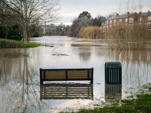
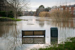
Eight flood alerts are now in place across Shropshire as the Environment Agency (EA) warns that the River Severn is on the rise.
The Environment Agency (EA) has warned that river levels are expected to rise in the next 48 hours.
It comes after a 40-hour weather warning for heavy rain was issued for parts of Wales and Shropshire.
The yellow weather warning came into force at 5am on Thursday (February 5) and will remain in place until 9pm on Friday.
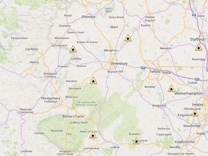
As of 2pm on Friday, the EA had issued several flood alerts around the county - including for the River Severn - warning that flooding may affect low-lying land and roads next to the following waterways:
Flood alerts
River Severn - From Shrewsbury to Upper Arley. Locations that may be affected are White Abbey, Coalbrookdale, Ironbridge and Bridgnorth.
Severn Vyrnwy confluence - From the Welsh border at Llawnt to Shrawardine near Shrewsbury. Other locations that may be affected include Llanymynech, Maesbrook and Melverley.
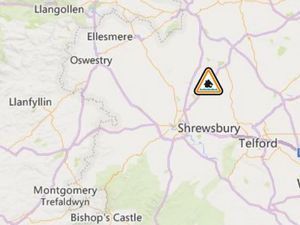
Tern and Perry catchments - From Wolverley to Newport. Other locations that may be affected include Market Drayton, Wem, and Rodington.
Rea Brook and Cound Brook - From Shrewsbury to Church Stretton. Other locations that may be affected include Minsterley, Pontesford and Harrington.
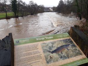
Upper Teme - Including the River Teme, River Onny and River Corve and their tributaries. Locations that may be affected include Bishop's Castle, Church Stretton, Knighton and Ludlow.
River Worfe - From Crackley Bank to Bridgnorth. Other locations that may be affected include Ryton and Burcote.
Ledwyche Brook and River Rea - Locations that may be affected include Cleobury Mortimer, Neen Sollars and Caynham.
Brooks in the Wyre Forest - From Acton Round to Noutards Green. Other locations that may be affected include Morville, Eardington, Highley, Wribbenhall and Rock.
River levels forecast
The Severn at Crew Green on the Wales border is expected to peak at between 5.1m and 5.4m on Sunday morning (February 8).
Flooding of property is generally possible here when the river level reaches 6.2m; the highest level recorded at this station was at 6.58m in February 2022.
Downriver in Ironbridge, the river is expected to peak between 3.8m and 4.1m on Sunday. Here, the top of the 'normal' range is 3.4m.
The EA says that property flooding is possible here when the river reaches above 4.8m. The highest level ever recorded at that gauge was just over 7m.
All flood alerts and more information about river levels can be found on the Environment Agency website at check-for-flooding.service.gov.uk.