Latest river levels forecast and warnings in Shropshire as Shrewsbury prepares for flooding
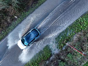
Preparations are being made as the River Severn in Shropshire is set to swell over the next 24 hours.
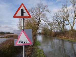
Two flood warnings and four flood alerts are currently in place around Shropshire, with the Environment Agency (EA) warning that river levels are expected to rise significantly in the next 24 hours.
Subscribe to Shropshire Star Plus now for just £1 a month for 12 months for exclusive content and an ad-free website. Visit the Shropshire Star website for our Black Friday offer
The warnings come after a yellow warning for rain was in place in Wales earlier this week, with experts predicting the wet weather would soon send water rushing down the mountains into rivers and over the border.
On Tuesday, December 2, flood warnings - the most serious alert issued by the EA - were in place for the River Vyrnwy at Maesbrook and Melverley.
The organisation said they were "closely monitoring the situation" and advised residents to "start acting on flood plans".
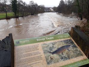
Flood alerts - meaning flooding is possible - were in place at the Severn Vyrnwy confluence, the Tern and Perry catchments, Upper Teme and the River Severn.
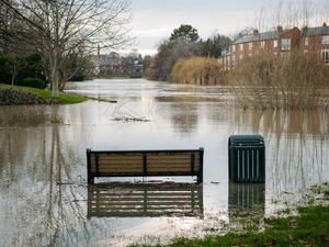
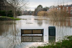
Ahead of the swell reaching the River Severn, Shropshire Council announced they would be closing Frankwell car park in Shrewsbury from around 8pm on Tuesday.
River levels forecast
The Severn at the Welsh Bridge in Shrewsbury is set to peak on Wednesday (December 3) morning, with the EA estimating the river will reach between 3m and 3.5m.
Here, the top of the 'normal' range is 2.7m and the flooding of property is possible above 2.9m. The highest ever level recorded at the river gauge was 5.25m, in November 2000.
Downriver in Ironbridge, the river is expected to peak between 4.4m and 4.8m overnight on Wednesday, where the top of the 'normal' range is 3.4m.
The EA says that property flooding is possible when the river reaches above 4.8m. The highest level ever recorded at that gauge was just over 7m.
The river levels in Bridgnorth are expected to reach 3.8m to 4.2m shortly after. The top of the 'normal' range here is 3.6m.
Flooding of property is possible when the river goes above 4.2m and its highest-ever peak was also in November 2000, at 5.26m.
All flood alerts and more information about river levels can be found on the Environment Agency website at check-for-flooding.service.gov.uk.