Flood barriers go up in Shrewsbury with some county roads under water as snow melts
Flood barriers have been put up by the Environment Agency in Shrewsbury as river levels continue to rise across the county.
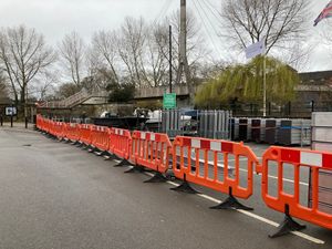
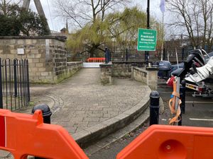
Barriers have gone up in the Frankwell car park, one of the most frequently flooded parts of Shrewsbury, as several days' worth of snow at the end of last week melts away.
Flood warnings, meaning flooding is expected, are in place for the River Vyrnwy at Maesbrook and Melverley.
Flood alerts, meaning flooding is possible, are in place for Rea Brook and Cound Brook, the River Dee catchment in England from Whitchurch to Chester, River Severn in Shropshire, Severn Vyrnwy confluence, Tern and Perry catchments and Upper Teme.
Shropshire Council has also closed a lane at the Coleham Gyratory to allow Severn Trent to deploy its pumps.
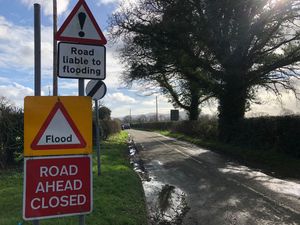
The council says melting snow and heavy rain is the cause of the rising river, which has already lead to some roads in Melverley and Maesbrook going underwater.
More information on current flood warnings can be found on the Environment Agency website: https://orlo.uk/xS8li.