Met Office thunderstorm warning issued for West Midlands with torrential rain and deep floodwater possible
A Met Office video explains which areas could see thunderstorms in the next few days, as the forecaster issues a weather warning.
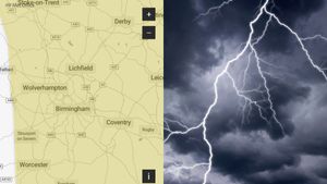
The Met Office has issued a thunderstorm warning for large parts of the West Midlands.
The yellow thunderstorm warning will be in place for the West Midlands conurbation including the Black Country as well as parts of Shropshire and Staffordshire, Warwickshire and Worcestershire from 9pm on Friday (July 18) to 6pm on Saturday (July 19).
The warning reads: “Areas of heavy, thundery rain may lead to disruption to transport and travel from late Friday through much of Saturday.
“Spray and sudden flooding could lead to difficult driving conditions and some road closures. Where flooding or lightning strikes occur, there is a chance of delays and some cancellations to train and bus services. Power cuts might occur and other services to some homes and businesses could be lost.
"Flooding of homes and businesses could happen quickly, with damage to some buildings from floodwater, lightning strikes, hail or strong winds. Fast flowing or deep floodwater is possible, causing a danger to life. Some communities might become cut off if roads flood.
“Rain will likely be locally torrential, bringing 20-30mm in less than an hour in many places, with 60-90mm in less than three hours possible in a few places. Whilst rain will clear from the south of the area by early Saturday afternoon, further thunderstorms are likely to develop here.
“As well as heavy rain, impacts from frequent lightning, gusty winds and large hail are also likely.”
West Midlands Met Office weather forecast
July 17 (day)
Cloud lowering through the morning, turning it misty and murky around some hills, with accompanying outbreaks of rain and drizzle. Brighter spells emerging in the afternoon but with the chance of showers, heavy and possibly thundery. Feeling humid. Maximum temperature 26C.
July 17 (night)
Scattered showers continuing overnight, the odd one of which may again be heavy and thundery. Clear spells developing in between with light winds. A warm and muggy night. Minimum temperature 16C.
July 18
Clouding over first thing but this eventually breaking to allow more sunny spells. Chance of an afternoon shower. Gentle winds and feeling warm in the sunshine. Maximum temperature 27C.
July 19 to 21
Unsettled. Showers may be heavy and blustery at times, carrying the risk of thunder and hail. Warm and humid in brighter periods, but temperatures suppressed under any persistent rain.