River Severn flood waters dropping across Shropshire - with photos
With fairer weather marking the first day of Spring and no further rain forecast, the flood waters that swept across Shropshire have started to recede.
Four flood warnings were still in place in Shropshire this morning and while river levels were dropping, some low lying roads and fields were still submerged.
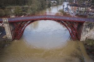
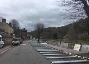
The Wharfage in Ironbridge was back open after flood barriers were taken down on Wednesday and the defences in Frankwell, Shrewsbury, were being removed this morning.
The car park in Frankwell was partially back open, but floodwater was still blocking spaces on the edges of the car park and Shropshire Council warned this was likely to remain the case until at least Thursday morning. All other car parks in the town were open as normal.
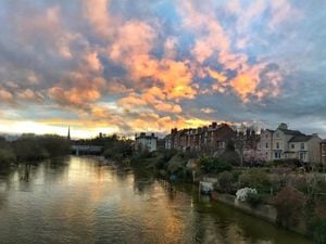
Meanwhile riverbank pathways in the Quarry and banks of the River Severn in Shrewsbury were slowly being exposed as the flood waters drop.
Karen Higgins took this photo of daffodils, which had been under inches of water at Coleham Head in Shrewsbury, nodding in the spring sunshine.
The fish pass at the weir in Shrewsbury was also once again open but any passersby were being warned by the Environment Agency to stay away from the area as the river is flowing fast.
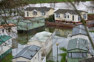
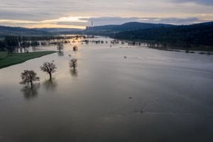
Chris Bainger from the Environment Agency was among several photographers who took up a drone to get a bird's eye view of the flooding.
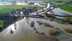
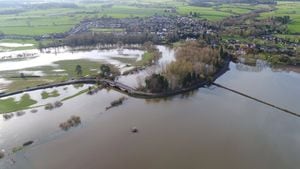
At Atcham it was clear to see that water levels were dropping as waterlogged fields became visible, while Wroxeter was also still flooded.
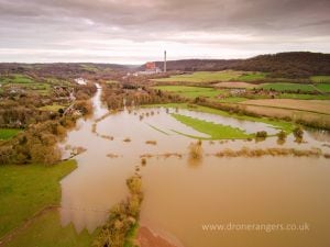
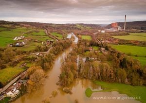
Meanwhile footage taken by Virtual Shropshire and Tom Blockley yesterday shows the flood water spilling on to fields close to Buildwas Abbey and Ironbridge Power Station.
GALLERY: Drone shots show Shropshire flooding
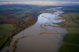
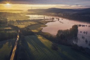
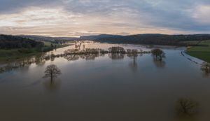
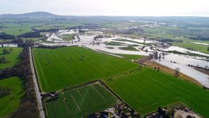
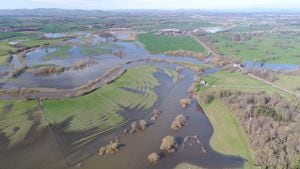
At Leighton the drone captured the extent of the burst river, which spread across fields and paths.
River levels remain high but are beginning to fall at the Bridgnorth river gauge.
And according to the Environment Agency, the risk of flooding is now reducing.
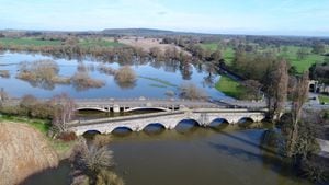
Flooding was affecting low lying land and roads adjacent to the river from Shrewsbury to Upper Arley.
Other locations that may have been affected included Coalbrookdale, Ironbridge and Bridgnorth.
The recorded peak at Bridgnorth was 4.2m yesterday morning and 5m at Buildwas yesterday morning.
Further downstream in Bewdley more than ten times the normal amount of water was passing under the bridge each second last night as the swell continued towards the sea.
An Environment Agency spokesman said: "No further rainfall is forecast and we expect river levels to remain high until this evening. We are closely monitoring the situation.
"Our incident response staff have removed temporary barriers from Ironbridge and Shrewsbury.
"Please avoid using low lying footpaths and roads near local watercourses and avoid contact with flood water."
Flooding was also affecting low lying land and roads adjacent to the river from the Welsh border at Llawnt to Shrawardine near Shrewsbury.
Other locations that may have been affected include Llanymynech, Maesbrook and Melverley and river levels at Cae Howel gauge peaked yesterday.