Eight flood alerts issued across Staffordshire and Shropshire as 'yellow' weather warnings remain in place across UK
Eight flooding alerts have been issues around rivers in Staffordshire and Shropshire amid 'yellow weather warnings' in parts of the UK.
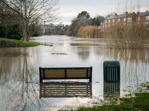
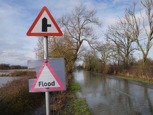
There were 74 flood warnings across the country, meaning flooding is expected, and 195 flood alerts, where flooding is possible, across England on Sunday night.
Jonathan Day, flood duty manager at the Environment Agency, said more than 24,000 homes and businesses have been protected but about 330 have been flooded.
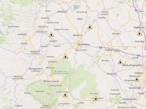
Eight flood alerts remain in place across areas of Staffordshire and Shropshire this morning (February 16) following a series of yellow weather warnings for cold weather conditions over the weekend.
As of 10am, the Environment Agency has alerts in place for the following areas:
Bourne Brook (Tamworth, Staffordshire)
River Sow and River Penk (Staffordshire)
River Worfe (Albrighton & Cosford)
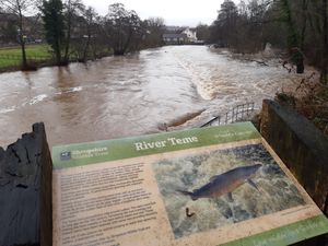
River Severn (Shropshire)
Tern and Perry catchments (Shropshire)
Severn Vyrnwy confluence (Shropshire)
Upper Teme (Aston-on-Clun)
River Lugg (north of Leominster)
The news comes as a yellow warning for ice is in force across parts of the UK. A series of warnings expired throughout the weekend, but a yellow ice warning is still in place covering eastern Scotland and north-east England until 10am on Monday.
In the warning areas, ice forming on untreated surfaces could lead to difficult travelling conditions, the Met Office said. The warning said: “Following a spell of rain and some hill snow during Sunday afternoon, temperatures will fall below freezing as skies clear from the west through the evening and overnight, leading to ice forming on untreated surfaces.”
Met Office operational meteorologist Dan Stroud said there could be some black ice and slippery surfaces in the yellow warning area, and warned people should take extra care.
He said: “Monday really is a day of sunny spells and blustery showers. Overnight Monday into Tuesday we will see a frosty start.
“It’s going to be a largely dry day, some decent amounts of winter sunshine. But it does start to go downhill later in the day, from the south and the west we’ve got a broad area of cloud and rain pushing in south-west England and South Wales late on Tuesday, during the course of Wednesday this will bring a mix of rain, sleet and hill snow.
“We do need to keep an eye on this system, there’s the potential for snow warnings to be issued. Thursday into Friday will be largely dry with some clear skies, turning milder towards the end of the week.”