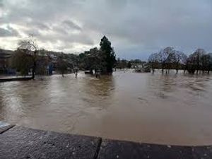
New flood warning issued in Shropshire this morning as heavy rain falls on county
More flood warnings are in place in Shropshire and the borders as rain continues to fall on saturated ground.

Overnight on Monday the red warning, meaning flooding is expected, was was put in place for Brimfield Brook at Orleton and Brimfield, south of Ludlow.
The Environment Agency warned that, with river levels are rising at the Orleton Millbrook Way river gauge as a result of heavy rainfall flooding of properties was imminent.
"We expect flooding to affect properties around the Brooklets, Wyson and Brimfield," the agency said.
It takes the number of warnings in the county and the Hereford border to eight.
There are five on the River Severn, at Bridgnorth, The Quarry in Shrewsbury, Ironbridge and Jackfield, Quatford, and Hampton Loade and Highley and two on the River Vyrnwy at Maesbrook and Melverley.
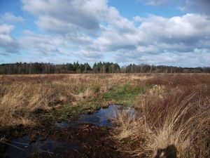
Less flood alerts are also in place on the length of the Severn through the county and on the Upper and Lower Teme, the River Worfe ,Tern and Perry catchments, the Rea Brook and Cound Brook and the Ledwyche Brook and Rea Brook as well as the River Lugg on the Shropshire Hereford border.
In Mid Wales, flood alerts have been issued for the Upper and Lower Severn catchments between Welshpool and Newtown, as well as the Vyrnwy catchment between Oswestry and Welshpool as well as the Lower Dee on the north Shropshire border.
The warnings are in place as a Met Office weather warning for rain, continues until to 9pm on Tuesday.
"Over the warning period, 15-30 mm rain is likely to fall fairly widely, with a few places seeing 35-50 mm," the Met Office said.
The River Severn was expected to peak at 3.6-3.7m at Shrewsbury's West Bridge on Monday evening, before reaching 5-5.3m at Buildwas on Tuesday morning. After that, a peak of 4-4.3m at Bridgnorth was expected later on Tuesday.
The Environment Agency warned levels could be pushed higher later in the week with more rain forecast over Tuesday and Wednesday, saying that a peak of 4.2-4.7m at Bridgnorth could be possible on Friday, based upon current forecasts.
In a social media update on Monday evening, the agency said: "Levels & times from this morning's peak tweet are still correct based on #rain that's already fallen.
"Multiple peaks & successive bands of rain forecast over the next few days will change this from Wednesday onwards."
Large parts of the UK are also covered by warnings for wind, including the whole of Shropshire and wider West Midlands, as well as most of Wales.
The Met Office has also issued two weather warnings for wind as Storm Henk blows in. A yellow one covers the Midlands - including Shropshire, southern England and south and mid Wales, while a stronger amber warning covers the south west, south east, eastern England and parts of Worcestershire and Warwickshire.
In the yellow warning, forecasters said: "Very windy conditions are likely to quickly develop over southwest England and southern Wales on Tuesday morning and then spread eastwards across southern and some central parts of England. In coastal areas winds are likely to gust towards 60 mph at times, with a lower likelihood of 70 mph gusts.
"Inland gusts of 40 to 50 mph are likely but with a smaller chance of 55 to 60 mph gusts, although the extent of such gusts carries low confidence at present. This windy weather will be accompanied by heavy rain in places, covered by a separate warning. Winds will start to ease from the west during the afternoon and evening."