Yellow ice warning in place as county recovers from Storm Christoph and heavy snowfall
Most transport is back to normal in Shropshire after an icy night, although a yellow weather warning was still in place this morning.
The county is returning to a sense of normality in the wake of the Storm Christoph flooding and heavy snowfall that followed.
However, a landslide has meant buses are currently unable to serve Whitehurst Pentre and Newbridge on the Oswestry to Wrexham services, but there is no other disruption that has been reported on the roads or railways.
An Arriva West Midlands spokesman said: "Most services are now back to normal lines of routes. Services 2 and 2A (Oswestry – Wrexham) are unable to serve Whitehurst Pentre and Newbridge bus stops due to a land slide. All 2/2A and morning 2cs are running out of Chirk to Cefn Mawr via the by pass."
There are currently no new school closures to report for today in Shropshire, Telford & Wrekin. In Powys, Montgomery C in W School is closed due to a Covid-19 outbreak, as well as Ysgol Rhiw-Bechan in Newtown due to a utilities failure.
The Met Office is carrying a yellow ice warning for the county. Its forecast said: "An icy start, before a wet week commences.
"Today, a cold, cloudy and icy start in the morning before a band of rain arrives from the west and slowly moves eastwards through the day, giving a wet day. Feeling cold, especially where any snow lies. Maximum temperature 6C.
"Tonight, any remaining rain from the day slowly clears eastwards, giving a dry night. Cloud cover becomes patchy, and some isolated fog patches may develop. Minimum temperature 0C.
"Tomorrow, any remaining showers clear turning the day dry but cloudy for most, although some southern parts continue to see patchy rain. Rain then arrives from the southwest during the night. Maximum temperature 8C.
"Outlook for Thursday to Saturday - showery Thursday morning, then turning dry briefly before further rain arrives during the night. Drier Friday, though patchy rain and showers continue for some. Dry, bright and cold Saturday."
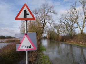
There are two flood alerts in place in the county - one for the River Severn and one for the Severn Vyrnwy confluence near Oswestry.
A statement on the Flood Warning Information Service website said: "River levels are now falling at the Montford, Welshbridge, Buildwas and Bridgnorth river gauges following recent heavy rainfall. Flooding of roads and farmland continues. Flooding is affecting low lying land and roads adjacent the river from Shrewsbury to Upper Arley.
"Locations that may be affected are White Abbey, Leighton, Gravel Hill Lane Shrewsbury, Coalbrookdale, Ironbridge, Bridgnorth and access to riverside Bridgnorth.
"River levels are falling at the Cae Howel river gauge following Storm Christoph. Levels are now below the flood risk threshold at Llanymynech and Maesbrook river gauges. Flooding of roads and farmland continues. We expect flooding to affect low lying land and roads adjacent to the river from the Welsh border at Llawnt to Shrawardine near Shrewsbury. Other locations that may be affected include Llanymynech, Maesbrook and Melverley.
"Further rainfall is forecast over the next 48 hours. We expect river levels to remain high for the next few days. We are closely monitoring the situation. Our incident response staff are checking defences. Please avoid contact with flood water."