More secrets of Shropshire's past revealed by drought
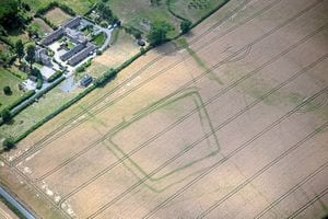
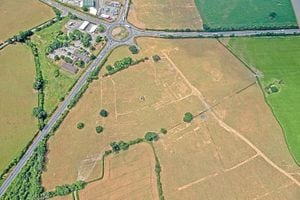
The scorching heat my be gone but these are some of the revealing images capturing mysterious ceremonial monuments, Iron Age settlements and Roman farms, discovered by archaeologists surveying the county’s parched landscape from the skies.
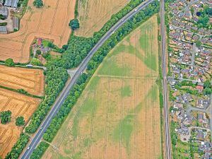
The dry summer has provided a real boon for aerial archaeologists, with the conditions leading to a large number of new discoveries across Shropshire.
Grant funding from Historic England has enabled Shropshire Council’s Historic Environment Team to carry out four wide-ranging reconnaissance flights.
A total of 22 never-seen-before sites were recorded during an aerial survey of some of Shropshire historic areas.
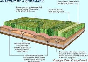
Duncan Wilson, chief executive of Historic England said: “This spell of very hot weather has provided the perfect conditions for aerial archaeologists to see beneath the soil as cropmarks are much better defined when the soil has less moisture.
“The discovery of ancient farms, settlements and Neolithic cursus monuments is exciting.
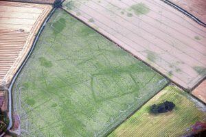
“The exceptional weather has opened up whole areas at once rather than just one or two fields and it has been fascinating to see so many traces of our past graphically revealed.”
The imagery has been catalogued and recorded in the council’s Historic Environment Record, to support the work of the team in ensuring the heritage of the county is effectively protected and managed by working with farmers, land owners and developers.
MORE: