Lambs take cover under mum as Shropshire gets a side-swipe off Storm Kathleen
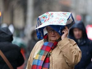
Gusts of around 40mph are expected this afternoon as the Shropshire region gets a side-swipe off Storm Kathleen.
Watch more of our videos on Shots!
and live on Freeview channel 276
The Met Office has issued a weather warning covering the west and mid Wales where the worst of the impacts of the deep low pressure system are expected to be felt.
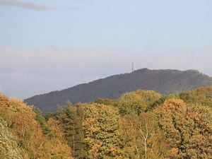
In Shropshire apart from a stiff breeze and gusts it is expected to be an afternoon of sunny intervals and a temperature of around 17C.
The windy weather was enough to persuade two lambs to take cover next to mum in a scene pictured by Peter Steggles in Gilberries Lane, on the way to Gretton, in Shropshire, on Saturday morning.
Meanwhile two flood alerts remain in place at the Severn Vyrnwy confluence and the Tern and Perry catchments. One for the Upper Teme upstream of Ludlow was removed on Saturday morning.
Flooding is expected on the land and roads adjacent to the river from the Welsh border at Llawnt to Shrawardine near Shrewsbury. Other locations that may be affected include Llanymynech, Maesbrook and Melverley.
Flooding is also expected to affect low lying land and roads adjacent to the river from Wolverley to Newport. Other locations that may be affected include Market Drayton, Wem and Rodington.
The Government's flooding website says: "We expect river levels to remain high over the next few days. Further rainfall is forecast over the next 24 hours and river levels could rise again. We are closely monitoring the situation. Please avoid using low lying footpaths near local watercourses and avoid contact with flood water."
Elsewhere dozens of UK flights have been cancelled as Storm Kathleen brings winds of up to 70mph - and potentially the hottest day of the year so far.
About 70 flights departing and arriving at UK airports before midday on Saturday have already been cancelled as the Met Office issued a yellow weather warning for wind.
The warning covers the north-west and south-west of England and parts of Northern Ireland, Scotland and Wales, from 8am to 10pm.
Met Office meteorologist Ellie Glaisyer told the PA news agency: "The storm is the reason we are seeing the warmer temperatures, because the location of the storm - situated out towards the west of the UK - is bringing a southerly wind across the UK.
"This is bringing those warmer temperatures from the continent, meaning we are likely to see temperatures reaching 22C."
The highest temperature of the year so far was 19.9C, recorded at the end of January at Achfary in north-west Scotland.
Ms Glaisyer added: "Almost anywhere is going to see above-average temperatures. Western parts of the UK are likely to see temperatures of 15 or 16C.
"However, the further west you are, where those strongest winds are in that yellow warning area, despite the temperatures being above average it will feel a little colder."
On Friday, the Met Office updated its weather warning to forecast stronger gusts during Storm Kathleen than previously predicted.
It warned of injuries and danger to life from "large waves and beach material being thrown on to sea fronts, coastal roads and properties", a possibility that "road, rail, air and ferry services may be affected" and the potential for power cuts and phone service outages.
Storm Kathleen will ease on Sunday evening, but another weather system towards the South West will replace it, Ms Glaisyer added.
She said: "Outbreaks of rain through Monday will mainly affect western parts of the UK. As we go through the day into Tuesday we're likely to see the strongest wind across the south-west of the UK.
"It's coming relatively quickly after Storm Kathleen.
"It's not out of the question that a warning could be issued but I wouldn't like to say yet."
Storm Kathleen, named by the Irish meteorological service Met Eireann, is the 11th named storm in eight months.
It is only the second time in a UK storm season that the letter K has been reached in the alphabet.
RAC Breakdown spokesman Rod Dennis said: "This intense period of stormy weather is going to prove extremely challenging for anyone driving on the western side of the UK.
"We strongly urge drivers to avoid exposed coasts and higher routes where the impact of the very strong winds is most likely to be felt."