Flood fears after torrential downpours bring weather warnings
Torrential downpours brought the risk of flooding to parts of Shropshire and mid Wales amid difficult driving conditions.
Met Office forecasters warned that “rainfall totals are starting to mount up” after heavy, persistent rain fell on Saturday and overnight into Sunday.
Large patches of standing water pooled on roads with spray a problem on busier routes.
Yellow weather warnings were put in place from 6pm on Saturday to 5pm on Sunday, warning of “persistent” rain and a risk of flooding across the north-west and south-west of England and Wales.
Two flood warnings were issued for the River Vyrnwy alongside eight flood alerts across Shropshire.
Further warnings and alerts were in place across parts of Wales.
Flood risk alerts
Flooding was expected on the River Vyrnwy at Maesbrook due to the heavy rainfall.
Environment Agency officials said flooding of property, roads and farmland is possible into Monday.
A spokesman said: "We expect flooding to affect properties and roads in and around Maesbrook including the A483 between Llanymynech and Four Crosses, just south of Llanymynech Bridge."
The river is expected to peak at Llanymynech at around 14.7ft (4.5m).
A further warning was issued for the river at Melverley.
There were flood alerts in place for Ledwyche Brook, near Ludlow, and River Rea.
River levels are forecast to rise at the Leintwardine and Onibury river gauges.
Rea Brook and Cound Brook, south of Shrewsbury, were also highlighted for alerts by the Environment Agency.
This was alongside the River Severn with officials saying water could gather on low lying land and roads adjacent the river from Shrewsbury to Upper Arley.
Water levels in the rivers Sow and Penk between Shropshire and Staffordshire were also high.
Roads next to the River Sow between Great Bridgeford and Shugborough, the River Penk between Coven and Stafford, the Sandyford Brook, the Rising Brook, the Ridings Brook and the Saredon Brook could be affected.
WATCH: Latest UK forecast
Just a week ago, parts of the country were basking in 26C heat.
Mark Wilson, a meteorologist with the Met Office, said: “It’s going to be a pretty unsettled 24 hours – we’ve already had pretty heavy rain across central and southern parts of the UK and those rainfall tallies are starting to mount up.
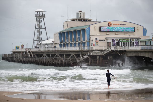
“It’s going to be quite wet across much of England, Wales and Northern Ireland and it will be quite windy particularly across the south coast, although through Sunday it will slowly clear its way eastward.
“There’s quite a wet day to come across most of northern England with some heavy showers moving up from the south – we will see some strong winds too.”
Mr Wilson said that Sunday would see a quieter evening, only for the heavy rain to return to much of the country on Monday.
Areas such as Devon and Cornwall could see coastal gales of up to 50mph, while between 30mm and 40mm of rain is expected to fall within the warning area over the weekend.
Cities including Manchester, Liverpool, Bangor, Swansea and Cardiff are also covered by the weather warning.
A fresh yellow weather warning is due to come into force at the beginning of next week, stretching from North Yorkshire down to the south of Wales.
On Saturday evening, Gwent Police reported that sections of road in the county were under water, while South Wales Police also warned of treacherous conditions.
South Wales Police tweeted: “There are some really poor driving conditions in parts of South Wales this evening, remember: Leave a safe and increased distance to the vehicle in front; give yourself extra time for your journey; use dipped headlights; be considerate of all other road users.”
Gwent Police posted: “We are receiving reports that the A4042 near the old Sainsbury’s site in Newport is completely flooded.
“The fire brigade and local authorities are attending shortly to try and clear the road. All motorists are advised to use alternative routes.”
Earlier on Saturday, a mudslide in North Yorkshire caused by heavy rain blocked train lines between Lancaster and Skipton.
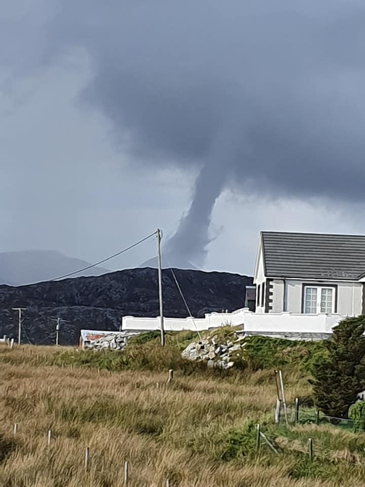
The bad weather follows on from an unsettled Friday, which saw a water spout form near the Isle of Scalpay in the Outer Hebrides, off the west coast of Scotland.
The weather warning has already led to the cancellation of the inaugural Regatta London race, which was due to take place on the River Thames on Sunday.
Organisers said they were unable to safely run the event due to “stormy weather” affecting the river’s water quality.