Warning of possible flooding from storms as heatwave comes to an end
The Met Office said heavy rain could cause some problems but temperatures would no longer be as ‘oppressively hot’.

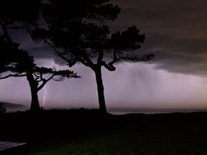
Storms and downpours could bring flooding across parts of the UK as the heatwave comes to an end.
A yellow warning for thunderstorms has been issued by the Met Office for parts of south-east Scotland and north-east England on Wednesday following the record-breaking heatwave.
Heavy showers are expected to develop across parts of the region, including Fife, Durham and Newcastle-upon-Tyne, with some places seeing up to 20mm of rain in an hour or less before the rain clears east into the North Sea later in the afternoon.
The forecaster warned of impacts from surface water flooding because of the amount of rain falling in such a short space of time, with the warning in place until 6pm.
Strong winds of up to 40mph could also develop, affecting areas including East Lothian and Edinburgh.
The South East will also experience some relief from the recent heat, with outbreaks of rain and a possibility of thunder in areas including Kent and Sussex.
Temperatures will be in the low to mid-20C across England and Wales, with a maximum of 27C in the South East, still markedly higher than the long-term average for the region of around 23C but lower than Tuesday, which at 34.7C was the hottest day of the year so far.
Scotland and Northern Ireland will see highs in the low 20s.
Wednesday night is expected to be largely dry with clear spells but cloud will increase in the north-west, bringing outbreaks of rain to west Scotland by dawn.
The South East will have a cooler night than recently, with a minimum temperature of 10C.
The Met Office forecasts that Thursday will be dry and warm in the south.
But it said the north-west would be unsettled, with scattered showers, clouds and isolated thunderstorms and stronger winds particularly in north-east Scotland in the afternoon.
Alex Burkill, a Met Office presenter and meteorologist, said heavy rain could cause some problems but temperatures would no longer be as “oppressively hot”.
He said: “There will be some heavy rain at times in the east and that could cause a little bit of problems in a few places because there could be some thunder mixed in with it.
“The heavy rain that’s pushing into parts of the South East – Kent, East Anglia, for example – some thunder is possible there, and also further north across parts of east England, maybe even the far south-east of Scotland could see some thunder as well.
“Otherwise, there will be a scattering of showers coming in across parts of Scotland to Northern Ireland, some sunny spells mixed in, but some fairly hefty showers possible.
“Across the bulk of England and Wales, it’s looking like a largely fine day, some decent sunshine on offer and feeling pretty warm in that sunshine too.
“Temperatures are nowhere near as high as they have been of late. We’re looking at highest temperatures probably around 26C – feeling warm but not as oppressively hot as it has been.”


