
When extreme heat warnings will be in force in Shropshire and Powys as temperatures forecast to hit 38°C
The Met Office has issued two amber extreme heat warnings for Shropshire and Powys as temperatures are predicted to reach 38°C.
The Met Office has extended an extreme heart warning for Shropshire and Powys this week as temperatures are forecast to hit 38°C.
An amber warning for extreme heat will be in place from 01:00 on Monday 22 June to 23:59 on Tuesday 23 June.
The warning reads: “A developing hot spell through Monday and Tuesday will likely lead to widespread impacts on people and infrastructure.
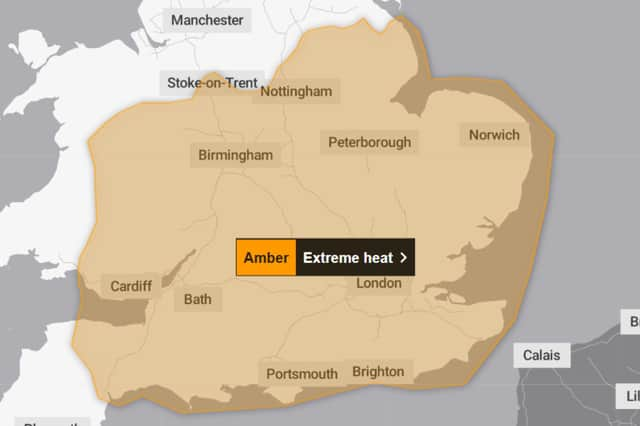

“More people are likely to visit coastal areas, lakes and rivers leading to an increased risk of water safety incidents. Adverse health effects are likely to be experienced by those vulnerable to extreme heat. The wider population are likely to experience some adverse health effects including sunburn or heat exhaustion (dehydration, nausea, fatigue) and other heat related illnesses.
“Some delays to road, rail and air travel are possible, with potential for welfare issues for those who experience prolonged delays. Some changes in working practices and daily routines likely to be required. An increased chance that some heat-sensitive systems and equipment may fail, leading to power cuts and the loss of other services to some homes and businesses.”
Another amber warning for extreme heat will be in force from 00:00 on Wednesday 24 June to 23:59 on Thursday 25 June.
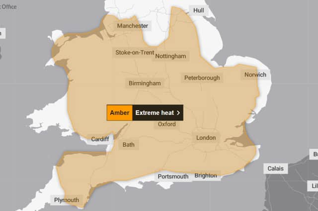
The second warning reads: “Hot and humid weather is expected to continue through the middle of the week, with exceptionally warm temperatures both day and night.
“Population-wide adverse health effects are likely to be experienced, not limited to those most vulnerable to extreme heat, leading to potential serious illness or danger to life.
“Substantial changes in working practices and daily routines likely to be required. Failure of heat-sensitive systems and equipment is likely, with the probable loss of power and other essential services, such as water, electricity, gas or mobile phone services.
“Significantly more people are likely to visit coastal areas, lakes and rivers leading to increased risk of water safety incidents.
“Delays on roads and road closures are possible, along with delays and cancellations to rail and air travel, with potential for significant welfare issues for those who experience even moderate delays.”
Tom Crabtree, Met Office Deputy Chief Forecaster, said: “The forecast heatwave is developing into an impactful severe weather event, with record breaking June temperatures and very high humidity. The combination of heat and humidity will be oppressive and bring impacts across society from public health and infrastructure, to power and water supplies.
“As well as very high daytime temperatures, there will be consecutive nights where temperatures do not drop below 20°C, which is called a Tropical Night. This will make it very hard for people to recover from the daytime heat, exacerbating the heat stress impacts.”
How hot is it forecast to get in Shropshire and Powys?
Monday 22 June - 31°C
Tuesday 23 June - 33°C
Wednesday 24 June - 35°C
Thursday 25 June - 37°C
Telford
Monday 22 June - 30°C
Tuesday 23 June - 33°C
Wednesday 24 June - 35°C
Thursday 25 June - 36°C
Oswestry
Monday 22 June - 29°C
Tuesday 23 June - 31°C
Wednesday 24 June - 33°C
Thursday 25 June - 35°C
Bridgnorth
Monday 22 June - 32°C
Tuesday 23 June - 35°C
Wednesday 24 June - 36°C
Thursday 25 June - 38°C
Llandrindod Wells
Monday 22 June - 29°C
Tuesday 23 June - 32°C
Wednesday 24 June - 33°C
Thursday 25 June - 34°C
Monday 22 June - 30°C
Tuesday 23 June - 32°C
Wednesday 24 June - 33°C
Thursday 25 June - 35°C
Llanidloes
Monday 22 June - 29°C
Tuesday 23 June - 31°C
Wednesday 24 June - 32°C
Thursday 25 June - 34°C
Llanfair Caereinion
Monday 22 June - 29°C
Tuesday 23 June - 31°C
Wednesday 24 June - 33°C
Thursday 25 June - 34°C
Llanymynech
Monday 22 June - 29°C
Tuesday 23 June - 32°C
Wednesday 24 June - 33°C
Thursday 25 June - 35°C
Newtown
Monday 22 June - 29°C
Tuesday 23 June - 32°C
Wednesday 24 June - 33°C
Thursday 25 June - 34°C
Llanfyllin
Monday 22 June - 28°C
Tuesday 23 June - 31°C
Wednesday 24 June - 32°C
Thursday 25 June - 34°C
Staying safe in cold water
The Met Office has warned that sea surface temperatures are not as high as they would be in mid-summer. The Royal Life Saving Society UK (RLSS UK) has free, accessible water safety resources available, as part of drowning prevention week this week.
You can find water safety advice on the Met Office website and in the Met Office app, featuring a dedicated beach forecast with tide times, wave heights and sea-surface temperatures, as well as guidance on UV and pollen levels.
Comment Guidelines
Iconic Media encourages reader discussion on our stories. User feedback, insights and back-and-forth exchanges add a rich layer of context to reporting. Please review our Community Guidelines before commenting.