
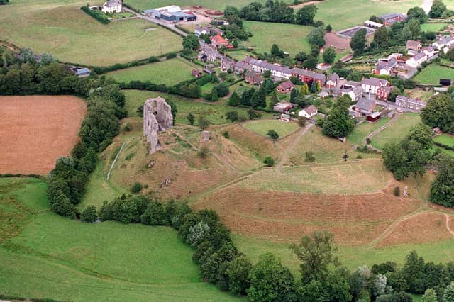

Some of you will remember that during the 1990s the Shropshire Star ran a series in partnership with Ordnance Survey called On The Map.
A central part of the project involved us sending up a helicopter with one of our photographers on board and capturing views from above of towns, villages, and features, which readers could then compare with a double-page reproduction of an OS map of the relevant area.
We’ve still got those pictures, and a lot can change on the ground in 30 years or so. Here are some of them, mostly from the western part of the county. Have fun poring over them and spotting the then-and-now differences.
Unless stated differently, the pictures date from the summer or autumn of 1994.
- You can enjoy this and more with our weekly FREE Nostalgia Newsletter - with scores of archive pictures and exclusive features on the history of Shropshire and Mid Wales - all sent to your inbox every week. Sign up here
- For anyone curious about where their own family story leads, MyHeritage DNA kits are currently £19.90, excluding shipping. The test can help explore genetic origins and identify DNA matches who may share branches of your family tree. This is an affiliate link. We may earn a small commission on items purchased, but that does not affect our editorial judgement.
9. Where to become an international golfer
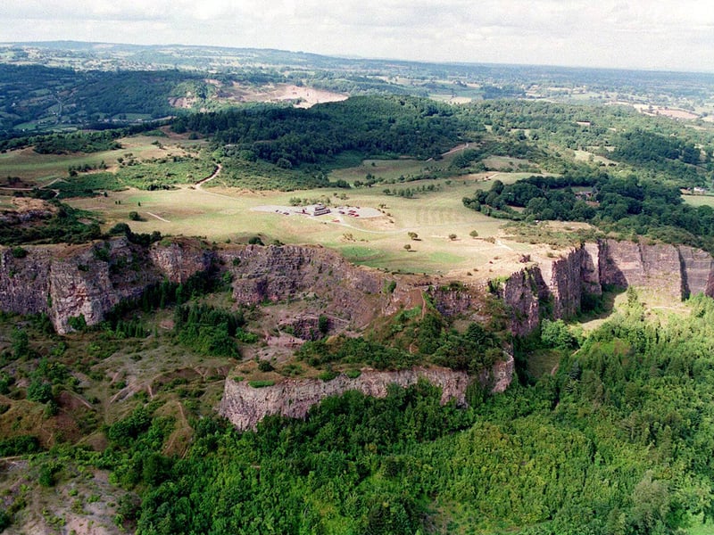
The effects of age-old quarrying are evident on this photo of Llanymynech Hill. Sitting on the top is Llanymynech Golf Club, from which there are magnificent views of the surrounding countryside. It is said to be the only golf course in Europe spanning two different countries. There are 15 holes in Wales and three in England. On the 4th hole you tee off in Wales and putt out in England, returning to Wales on the 7th tee. The top of the hill is also the site of an Iron Age hillfort, one of the largest in Britain. Some years ago researchers from Manchester University put forward the hill as a contender for the site of a great battle between British chieftain Caratacus and the Roman invaders in AD51. | Shropshire Star
10. Pontesbury as it was
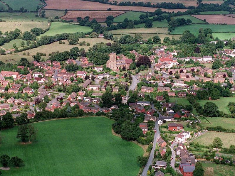
Pontesbury is at the heart of Mary Webb country. Shropshire's best loved author, who was born Gladys Meredith, wrote her first novel, The Golden Arrow, when she lived at a house called Rose Cottage in the village. St George's Church stands proud at the centre of Pontesbury. Historic England says: "A Saxon minster church, the parish of Pontesbury was formerly divided in three portions, an arrangement dating back until at least the 13th century and which persisted until 1909. The church stands in a roughly oval-shaped enclosure, a feature of early foundations." For villagers this picture depicts the old times, as Pontesbury has seen a number of housing developments since. | Shropshire Star
11. Oswestry - a historic railway town on the Welsh border
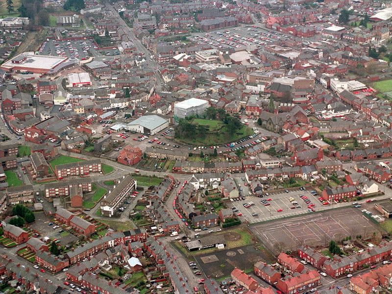
Oswestry town centre in about January 1999. In the middle is the site of the town's Norman castle, now just a mound which is open to the public and offers a good view over the surrounding rooftops. What is not apparent in the photo is that Oswestry was once a big railway town. It continues to celebrate and cherish that heritage. There is a museum, and heritage trains operate on selected days between Oswestry and Weston Wharf. | Shropshire Star
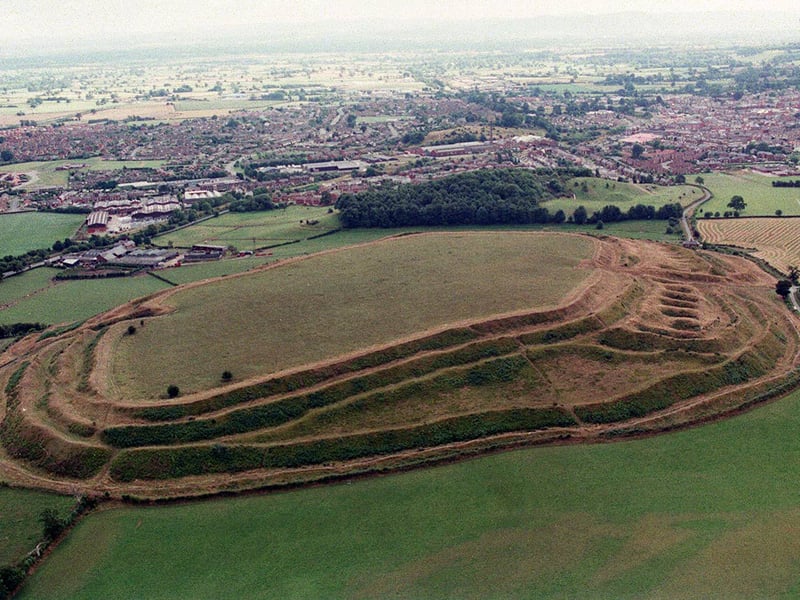
12. Fort for the day
Old Oswestry is one of the most magnificent and best preserved hillforts in Britain, although in modern times there have been concerns about the encroachment of housing. The impressive defensive ramparts were not all built at the same time. During the Great War it was used as a military training area. | Shropshire Star