
Great British weather brings 'tornado'
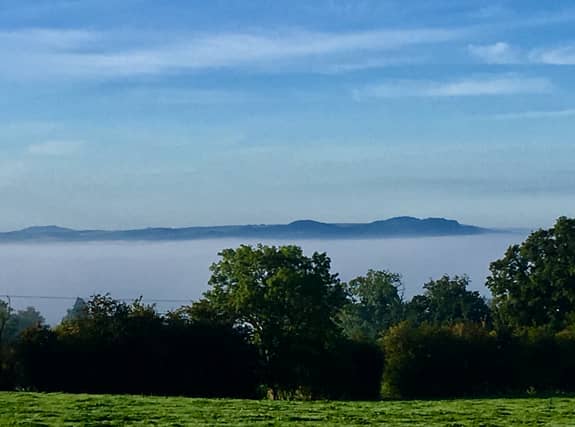

The great British weather has thrown everything at us this week from torrential rain and a 'tornado' to still Autumn fog that blanketed the county and today a rise in temperatures from a southerly wind.
Changeable is certainly the byword for the weather in Shropshire and mid Wales
Motorists who had to cope with heavy downpours and flash flooding on Monday evening, found their drive into work on Tuesday hampered by fog that covered much of the region until the sun burnt it away.
Those on high vantage points like Welsh Frankton near Ellesmere had the best view of the fog with hills from the Wrekin to the Berwyns poking out of the top of what looked like cotton wool.
Twitter users believed we had been hit by a mini tornado on Monday, tweeting photos of what looked to be a 'tornado' over Shropshire.
Similar images were tweeted across the Wolverhampton area.
One was taken from a train as it passed through the city with another showing heavy cloud and the 'tornado' over rooftops.
Ian C Ashford also posted an image on Facebook showing the clouds above the skyline.
Although it may have looked menacing it was what is known as a 'funnel cloud.' These are not uncommon at this time of year and do not have the destructive potential of a tornado.
The Met Office website says a funnel cloud is 'a cone-shaped cloud which extends from the base of a cloud towards the ground without actually reaching the surface'.
Tornadoes do reach the ground and in a typical year the UK sees between 30 and 35.
Heavy rain was set to reach Shropshire from the west this evening and contine into Thursday with temperatures dropping again.
Comment Guidelines
Iconic Media encourages reader discussion on our stories. User feedback, insights and back-and-forth exchanges add a rich layer of context to reporting. Please review our Community Guidelines before commenting.