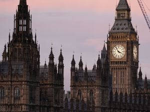
Snow showers and freezing fog set to hit UK in coming days
Yellow weather warnings for ice and snow cover almost the entire nation at points throughout Thursday and Friday.
Snow showers and freezing fog is forecast to sweep the UK in the coming days.
The Met Office has issued yellow weather warnings for snow and ice covering almost all of the nation throughout Thursday and Friday.
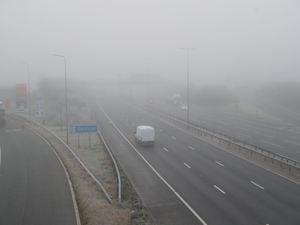
Warnings for snow and ice likely to cause slippery surfaces and travel disruption until midnight on Wednesday are in place for Scotland, and for Northern Ireland the same warning is in place until 9am on Thursday morning.
From Thursday afternoon until Friday morning, a yellow warning for ice covers the north and the entire east and west coasts of England and Wales, with only a small portion of central southern areas free from warnings.

The Environment Agency has also issued four flood warnings for areas where flooding is likely, on the Isle of Sheppey, Kings Lynn, Peterborough, and by the River Derwent in North Yorkshire.
Some 30 alerts, for areas where flooding is possible, are also scattered across England.
There were no high water warnings in place for Scotland, Wales, or Northern Ireland on Wednesday night.
Snowfall is expected in the northern half of Scotland on Thursday, with 1-2cm depth covering lowland areas, and up to 10cm expected to fall in areas higher than 300m above sea level.

Met Office meteorologist Clare Nasir said this wintry weather will be brought on by a “bank of rain which readily turns to snow” moving from Scotland and Northern Ireland in the early hours of Thursday, to England and Wales as the day progresses.
Freezing temperatures ranging from 0C in London to -10C in the valleys in Wales are predicted overnight, picking up to between 2-5C for most places in the UK in the daytime.
Ms Nasir said: “Watch out for some freezing fog patches (and) the risk of ice first thing.
“However, through the morning, we will see some brighter skies for southern parts of England and Wales.”
Ambulance services have urged people to plan their journeys ahead of setting off and to wrap up warm to ease pressures on emergency services.
The risk of icy weather and wintry showers is set to persist through Friday, with cloudier and milder weather moving in from the north and patches of sun across the country.
A yellow weather warning for snow is in place for north-east Scotland from midnight on Thursday until midday on Friday, and an ice warning covers Wales and much of England with the exception of some central and southern areas until 11am on Friday.