The new walking and cycling routes planned for seven Shropshire towns in detail
A new plan setting out a catalogue of improvements to walking and cycling routes across Shropshire is set to go out to public consultation.

But what is being proposed? The county’s first ever draft Local Walking and Cycling Infrastructure Plan (LCWIP) details hundreds of schemes from widening footpaths and creating segregated cycle lanes, to providing new road crossings and bridges.
With a focus on Shrewsbury, Oswestry, Ludlow, Bridgnorth, Market Drayton, Whitchurch, Church Stretton, and their hinterlands, the council hopes the improvements will encourage more people to choose active modes of travel wherever possible.
A wish list of proposals has been drawn up for each town, with schemes ranked in order of priority based on their effectiveness and deliverability.
Once the LCWIP is adopted, after the public consultation, the next challenge for the council will be getting the funding to see it all through.
Here are the proposed schemes for each of the seven towns:
Shrewsbury
Two of the top 10 priority schemes for the county are in Shrewsbury.
Top of the list is to review the weight and width limits on Welsh Bridge, to see what “innovative solutions” can be drawn up given its physical constraints. The report says improving Welsh Bridge is important “as the nearby and parallel active travel bridges have accessibility constraints”.
The next most important project is to connect missing sections of infrastructure along St Michael’s Street and Castle Gates by providing a segregated cycle lane.
Other top-scoring schemes include improving cycle access across the railway station from The Dana to the town centre, and reducing traffic speeds along Breeches Lane and Town Walls to offer cyclists a safe route through the town centre while avoiding the steep incline of Wyle Cop.
It is also proposed to upgrade the existing cycle route along Shelton Road and improving crossing facilities.
More segregated cycle lanes are proposed for major routes including Mytton Oak Road, Ellesmere Road and Abbey Foregate, and along the A49 linking Bayston Hill to Meole Brace.
The report also says a cycle route should be created through the town centre including St John’s Hill, Shoplatch and Pride Hill.
Oswestry
Seven of the top 10 prioritised schemes for the whole county are in Oswestry.
The document says: “On the whole Oswestry scored higher than the other towns, particularly due to potential mode shift and growth.
“This is likely a result of not having an active railway station, therefore many of the schemes are aiming to link the town centre with the Orthopaedic Hospital and Gobowen station, as well as including an industrial estate.”
At the top of the list is a plan to upgrade the existing shared path along Gobowen Road, linking the town centre to employment and retail areas on the outskirts.
Next is to look at creating segregated cycle lanes, improved crossings and an extended 20mph speed limit for a route following Oak Street, York Street, Liverpool Road, Old Fort Road, Wat’s Drive and Coppice Drive.
Roads including Beatrice Street, Leg Street and Castle Street could also see 20mph limits imposed, along with traffic reduction measures.
The report suggests permitting cycling through pedestrianised areas in the town centre, and adding cycle parking.
To improve access to Gobowen, the report says a scheme “to extend the current cycle path along the existing railway corridor” was looked into, but “did not align with plans to run a shuttle rail service”.
Instead, the path between the village and Five Crosses roundabout on the A5 could be widened and lighting added.
The route between the roundabout and Oswestry would then be improved, with crossings added to the roundabout and a shared path provided all the way to town.
A longer-term project is also proposed to provide a ‘greenway’ route for walkers and cyclists alongside a restored rail line.
Connections between Oswestry and surrounding villages including Morda, Whittington, Trefonen, Weston Rhyn and West Felton are also set for improvements such as upgraded cycle paths or lanes, widened footpaths and new 20mph limits.
The route from Oswestry to Pant could see a continuous path provided alongside the A483.
Ludlow
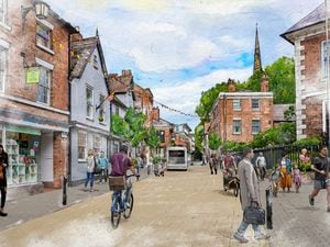
Ludlow’s historic town centre could be closed to general traffic to improve facilities for pedestrians.
The proposal is one of the top-scoring schemes in the town’s prioritised list, and could also see Castle Street Car Park repurposed as a ‘community space’.
However, the first priority Ludlow is to introduce cycle lanes along Sheet Road, to improve access between the town centre and the residential area to the east of the bypass.
The scheme would also include making it easier for pedestrians and cyclists to cross the A49.
Another quick win is to provide space for cycling along Tower Street, the plan says.
Meanwhile a shared pedestrian and cycle path could be created along the public right of way from the Rocks Green development, across the A49 and towards the town centre.
Cycle lanes are suggested for roads including Henley Road, Lower Galdeford, Station Drive, Old Street and Corve Street.
Two ‘low traffic neighbourhoods’ are proposed, one for Steventon New Road and Temeside and one for St Julian’s Avenue and Livesey Road. This would mean removing through traffic and improving facilities for pedestrians and cyclists.
Bridgnorth
The topography of Bridgnorth is described as a “significant barrier for the use of active travel to get between the two parts of the town”.
The document says: “The increasing popularity of electric bikes may have the potential to reduce the effects of this barrier, but the majority of walking, wheeling and cycling journeys are likely to be made within the two separate parts of the town independently.”
Ranked in order of priority, the first thing on the list is to reduce the speed limit on Whitburn Street to 20mph.
New crossings are proposed for the A442 at the St John’s Street junction and on St John’s Street itself, as well as one on High Street.
Another priority is to create a cycle route linking High Town and Low Town, along the Cartway, closing part of it to through traffic, while St Mary’s Street could also be closed and turned into an active travel only route.
Segregated cycle lanes could be implemented on Kidderminster Road, along with widening of the pavement.
A number of changes are suggested for the bridge connecting High Town and Low Town, including having a wider pavement on one side rather than narrow pavements both sides, and introducing a 20mph limit. The bridge could also be made one-way, with contra-flow cycle lanes, and a safer crossing added on the High Town side.
However a longer-term goal is to investigate adding a new pedestrian, cycle and equestrian bridge over the river.
Market Drayton
The highest-ranked scheme in Market Drayton is the introduction of segregated cycle lanes from the centre of town along Maer Lane to the industrial estate.
Next in line is to create cycle lanes along a route through the western and central residential areas to the town centre, including Bridge Street, Longslow Road and Prospect Road.
Other roads earmarked for segregated cycle lanes include Shrewsbury Road, Cheshire Street, Adderley Road, Smithfield Road and Frogmore Road.
A ‘greenway’ active travel route is being put forward for the disused railway corridor parallel to Prospect Road.
Farcroft Drive could see a 20mph speed limit imposed along with traffic reduction measures, and low traffic neighbourhoods could be created in the area around Rowan Road.
A long-term scheme put forward in the report includes a trial removal of parking on Stafford Street to the west of the A529 roundabout, on High Street north of Shropshire Street and on Shropshire Street between High Street and Frogmore Road, to make space for a two-way segregated cycle path.
Proposals are also made for improving connections between the town and its surrounding villages and RAF Tern Hill.
Whitchurch
The report says there is a need to improve the route between the town centre and the railway station, but says there is limited space on Station Road for cycle provision.
Instead, it suggests the footpath along Station Road, from the railway station to the Bridgewater Street/Brownlow Street junction, be widened and turned into a shared path.
A similar proposal is put forward for the route along Claypit Street and Alport Road, improving access to the hospital.
Another shared path could be created to link the town centre with residential areas to the north, along Talbot Street. This scheme could see double yellow lines implemented on one side of the road to reduce parking, with the introduction of residents’ parking permits.
Existing cycle lanes along Sedgeford, between Newport Road and the B5476, could be widened and brought up to current government standards.
The report proposes closing the route from the town centre to Station Road along Green End to motor traffic, or, “as a minimum”, adding contra-flow cycle lanes.
A contra-flow cycle lane could also be implemented on the route along Church Street and Claypit Street, connecting London Road/Brownlow Street to the High Street.
Church Stretton
Access to the railway station is top of the list for Church Stretton.
The first proposal is to create a crossing of Sandford Avenue to allow easier access to the station from the west.
A new crossing is also proposed over the A49 at the Crossways junction, to provide access to the station from the east for cyclists.
Another priority for the town is to introduce traffic calming measures to make the B5477 – along Shrewsbury Road, High Street and Ludlow Road – more active travel friendly.
The report says: “Removal of on street parking and/or reinstating the gyratory system would give more space to active travel.”
Two options are put forward for improving access between the town centre and eastern residential areas. One would follow Coffin Lane or The Narrows, and would include replacing the footbridge over the railway line with a step-free bridge, as well as creating a new crossing over the A49.
The alternative route would follow Snatchfields Lane and Chelmick Close, with upgrades to the existing public rights of way and improved signage, linking up to the proposed new A49 crossing at the Crossways junction.
Links between the town and the nearby villages of All Stretton and Little Stretton could also be improved with the addition of segregated cycleways along the A49.
Longer-term, there is a proposal to improve the cycle route from the north-eastern residential area westwards towards the schools.
The report says this could include a step free bridge at the level crossing, as well as utilising the playing fields as an “active travel hub”, with information and cycle parking.