More rainfall and thunderstorms on way with weather warning issued - with video and pictures
Half a month's worth of rain fell in 24 hours across parts of the country – as the heatwave turned into a washout.

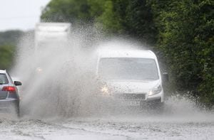
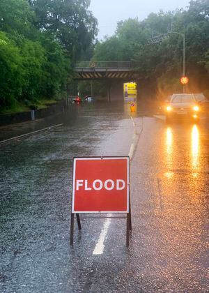
Heavy rain battered the region at the weekend and more rainfall and thunderstorms are predicted to be on the way.

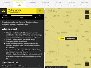
A yellow weather warning was put in place until midnight last night with the risk of flooding in parts of Shropshire, the West Midlands and Staffordshire.
But temperatures are expected to rise and reach 22C (71.6F) by this afternoon (, with bright and sunny spells expected before the rain returns.
See this morning's forecast from The Met Office here:
It comes after the region was hit by a heatwave last week, with areas reaching sweltering highs of 30C (86F).
But now a warning for thunderstorms has been issued by the Met Office for tomorrow , with heavy and thundery showers expected.
People were warned of disruption to transport, with sudden flooding potentially leading to road closures.
Temperatures will remain around 20C (68F), returning to normal for this time of the year.
A spokesman for the Met Office said: "Winds will be light on Monday, making it feel pleasantly warm in the sunshine.
"Clouds will break at times to give some bright or sunny spells.
"It will remain unsettled through Tuesday and Wednesday with the risk of heavy and thundery showers, interspersed with brighter spells.
"It will turn drier by Thursday with some sunshine. It will feel rather warm and humid."
Rain battered other parts of the country last night , with the weather conditions delaying passengers at Gatwick Airport.
And a Lamborghini crashed into the side of a road after losing control on standing water in Greater Manchester.