
Severe rain warning as more thunderstorms expected in Shropshire
Heavy rain and thunderstorms are expected today, bringing the risk of more flooding and travel disruption.
People hoping for dry half-term weather have instead been told to beware of potential flash floods, as sunny patches are replaced by storms expected to start this afternoon and continue overnight.
The latest forecast comes just days after torrential downpours brought a month's worth of rain in just hours on Sunday.
Tragedy struck when a man died after his van was submerged in water in Walsall, while homes in Albrighton and Muxton flooded, as did Welshpool's Victoria Memorial Hospital.
WATCH: Latest weather forecast
The Met Office has issued a yellow warning for rain covering all of Shropshire this afternoon, while a more serious amber warning covers south of the county.
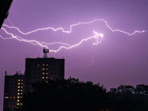
Relentless rain, strong winds, hail and lots of lightning are all a possibility according to the weather agency, although no specific flood alerts have been issued for Shropshire.
Under the amber warning - which covers the south west, Worcestershire and Herefordshire but stops just south of Ludlow - the Met Office says:
Flooding of homes and businesses is likely and could happen quickly, with damage to some buildings from floodwater, lightning strikes, hail or strong winds.
Fast flowing or deep floodwater is possible, causing a danger to life.
Where flooding or lightning strikes occur, delays and some cancellations to train, bus and air services are likely.
Spray and sudden flooding probably leading to difficult driving conditions and some road closures and some communities likely to become cut off if roads flood.
Power cuts are likely to occur and other services to some homes and businesses could be lost.
The yellow alert covers all of Wales, Shropshire, the West Midlands, parts of the north west and much of the south of the country and warns of similar potential consequences but with a reduced chance of them happening.
The yellow 'be aware; warning is valid from 11am on Thursday until 9am on Friday, while the amber 'be ready; alert lasts from 4pm on Thursday until 6am on Friday.

Heavy rain was expected to arrive in the south of the county from lunchtime, with thunderstorms likely later in the afternoon. Temperatures were expected to peak at around 23C (74F).
A Met Office spokeswoman said: "It's fairly normal weather for us to see thunderstorms through the summer months as temperatures warm up. Thunderstorms are caused by the warmer air."
She said most summer rain comes in short, sharp, heavy showers, adding that what is unusual is the longevity of this period - with the risk of thundery showers lasting through the week.
While some places will escape the worst of the rain, or even manage to stay largely dry, some rain will be heavy and up to 1.2in (30mm) could fall in an hour or less and 1.6in-2in (40mm-50mm) could fall in a couple of hours.
Thirty flood alerts are in place for England on Thursday, but none are in Shropshire. No flood alerts have been issued for Wales.